Online since October of 2007


Bigbaywx more information Bigbaywx


mount mesnard more information Mount Mesnard


visit our other weather sites:

Template documentation
and downloads

And another site


CBI


Information from NOAA Storm Prediction Center at this website

More SPC info on this site: 

SPC Day 4-8 Outlook

Updates are issued at 400 am CST/CDT (0900/1000 UTC) - Current UTC time: Apr 24 2024 3:25 am


Day 1

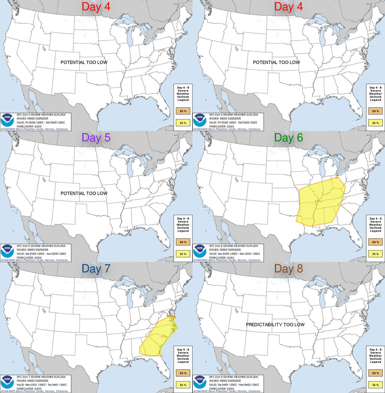
D4Friday Apr 26 2024 - Saturday Apr 27 2024 D7Monday Apr 29 2024 - Tuesday Apr 30 2024
D5Saturday Apr 27 2024 - Sunday Apr 28 2024 D8Tuesday Apr 30 2024 - Wednesday May 1 2024
D6Sunday Apr 28 2024 - Monday Apr 29 2024 (All days are valid from 12 UTC - 12 UTC)
PREDICTABILITY TOO LOW is used to indicate severe storms may be possible based on some model scenarios. However, the location or occurrence of severe storms are in doubt due to:
1) large differences in the deterministic model solutions,
2) large spread in the ensemble guidance, and/or
3) minimal run-to-run continuity.

POTENTIAL TOO LOW means the threat for a regional area of organized severe storms appears highly unlikely during the entire period (e.g. less than a 30% probability for a regional severe storm area across the CONUS through the entire Day 4-8 period).
        
000 ACUS48 KWNS 230900 SWOD48 SPC AC 230859 Day 4-8 Convective Outlook NWS Storm Prediction Center Norman OK 0359 AM CDT Tue Apr 23 2024 Valid 261200Z - 011200Z ...DISCUSSION... A complex but active pattern is expected from D4/Friday through D6/Sunday, as multiple mid/upper-level shortwave troughs impinge upon a moist and unstable environment extending from the southern/central Great Plains into parts of the Midwest and Mississippi Valley. ...D4/Friday - Central/southern Plains into the mid MS Valley... A negatively tilted shortwave trough is forecast to move northeastward from the Great Plains toward the mid/upper MS Valley on Friday. Most guidance suggests that convection developing late in the D3/Thursday period will be ongoing Friday morning, potentially posing an organized severe threat as it moves eastward. The influence of early convection on warm sector evolution by Friday afternoon/evening remains uncertain, but in general, moderate destabilization will be possible along the Pacific front/dryline in the wake of early convection, with some intensification of early storms also possible farther east. Details regarding storm mode remain uncertain at this forecast range, but in general, severe storms capable of producing large hail, damaging winds, and a few tornadoes will be possible across a broad region from the eastern Great Plains into the mid MS Valley. ...D5/Saturday - Central/southern Plains into the Midwest/mid MS Valley... The negatively tilted shortwave trough and attendant occluding surface cyclone are forecast to gradually weaken as they move across the upper Great Lakes region on Saturday. Depending on timing of the departing cyclone and magnitude of diurnal destabilization, some severe-thunderstorm threat could evolve in advance of this system through the afternoon across parts of WI/IL into MI, but confidence remains too low to include 15% probabilities for this area. Meanwhile, another strong shortwave trough is forecast to eject across parts of the central/southern Plains Saturday afternoon and evening, accompanied by strong surface cyclogenesis across the central High Plains. Moderate to locally strong instability may redevelop along/east of the dryline across central/western KS/OK into north TX, as low-level and deep-layer shear strengthen through the day. The synoptic pattern depicted by much of the extended-range guidance is suggestive of an active severe thunderstorm episode along/ahead of the dryline, though some guidance (notably recent runs of the ECMWF) suggest potential for early development across parts of OK/north TX, which could complicate the scenario by late afternoon/evening. Some severe threat could spread toward parts of the mid MS Valley late in the period. ...D6/Sunday - ArkLaTex into parts of the Midwest... Predictability begins to decrease by late in the weekend, though in general, a mid/upper-level trough and attendant surface low are forecast to move from the central Plains toward the upper Great Lakes region. A corridor of severe thunderstorm potential is forecast to extend south-southwestward from the surface low, as a trailing cold front moves through a moist, unstable, and favorably sheared environment. A 15% area has been added where confidence is currently greatest in severe-thunderstorm potential Sunday afternoon and evening. ..Dean.. 04/23/2024

Day 2

Day 3

Largly based on original scripts from Ken True: saratoga-weather.org and Rick Curly: ricksturf.com

you find our weather info also at:

Weather Underground

midwestern weather network

WeatherlinkIP

Citizen Weather Observer Program (CWOP)

equipment we use:

weather-station
Davis VP2

weather-program
Davis Weatherlink.Com

Davis VP2

Davis Weatherlink.Com